Saturday, August 03, 2013

7 peaks over 2,000 meters in 5 hours, 2 cars, 2 hikers and a dog

3 Agosto
The first part of this hike, from forca di Presta to Pizzo di Diavolo has alway been one of my favorites.  The views are incredible and the people are sparse.  I have written before about choosing your hikes in the Sibillinis, and for those of you who want to check off the tallest peak in Le Marche, you can start from either this trail's beginning or its end.  Obviously if you do the latter, you will do this hike in reverse and end up doing 8 summits over 2,000 meters and you are tougher than me, probably.
We started this hike at 0835 from forca di Presta above Arquata del Tronto to the southeast and Castelluccio to the northwest.  At 1600 meters rounded off, you have only 800 meters of altitude gain to reach these summits (not counting the saddle descents and re-ascents of the subsequent  peaks which are not difficult).   Head on up to the little rifugio Zilioli and take a left.
Heading up, sometimes seems like straight up, from forca di Presta to Prato Pulito, that point on just to the right of center photo.

A puppy left at the refuge or escaped from one of the local shepherds was thirsty and hungry, so he got a bit of Bacco's ration of water and dog biscuits.

The top of Prato Pulito on the left and Cima del Lago distant right
This picture from my hiking buddy, Sven and his panoramic capable iphone shows Prato Pulito to the right, Cima del Lago to the left and then continuing right from Cima, Redentore and Pizzo di Diavolo which are your next stops.  For us, it was 1 hour and 15 minutes to the refuge from forca di Presta, and to include pizzo di Diavolo and a return to Redentore (it's a dead end) figure another hour and a half.
One of the best things about this hike are the views of lago di Pilato below, which you can't see from Vettore unless you add a leg to that hike.

You can also see the marvelous Piano Grande of Castelluccio from all along the crest

Looking back from Mt. Redentore, you see my friend Sven walking on the edge
The 20 or so roundtrip hike from Redentore to Pizzo di Diavolo is one of the few "hairy" hikes I have done in the Sibillini mountains. It gets pretty narrow along here with a steep drop on both sides, but is well worth it for the views from this mountain "peninsula"

Looking towards Mt. Sibilla from Pizzo

The view of the Sella (saddle) delle Ciaule where you see the trail leading down from the flank of Vettore to either the scenic overlook of Lago di Pilato or the descent to the lake.  In the distance you see all the way to Gran Sasso, tallest mountain in southern Italy

This photo shows the last 2 named peaks Bacco and I had not done over 2,000 meters.... but, we are on our way!

Love this panorama with Bacco and I atop Pizzo di Diavolo, Vettore just slightly to its right then far right you see Cima del Lago
Mt. Osservatorio, you just walk along this crest down from Redentore to forca Viola and you finish up all those hidden, unknown 2,000 meter peaks

Bacco  along the crest looking towards Mt. Sibilla

Bacco atop Quarto San Lorenzo

Finishing the last supra-2,000 meter peak in Le Marche. Bacco and I, as far as we know, have now done them all.

This is the last un named mountain (Mt. Bacco?) over 2,000 meters looking down into the valley where you find the town of Foce and lots of scouts camping right now.

No trail down from Mt. Bacco (haha), just a steep descent.

Looking back at where we have been with Mt Bacco, Quarto San Lorenzo, Osservatorio, Redentore all visible from the last part of this trail which involves a 3 km walk along a road to return to Castelluccio where we left the 2nd car.
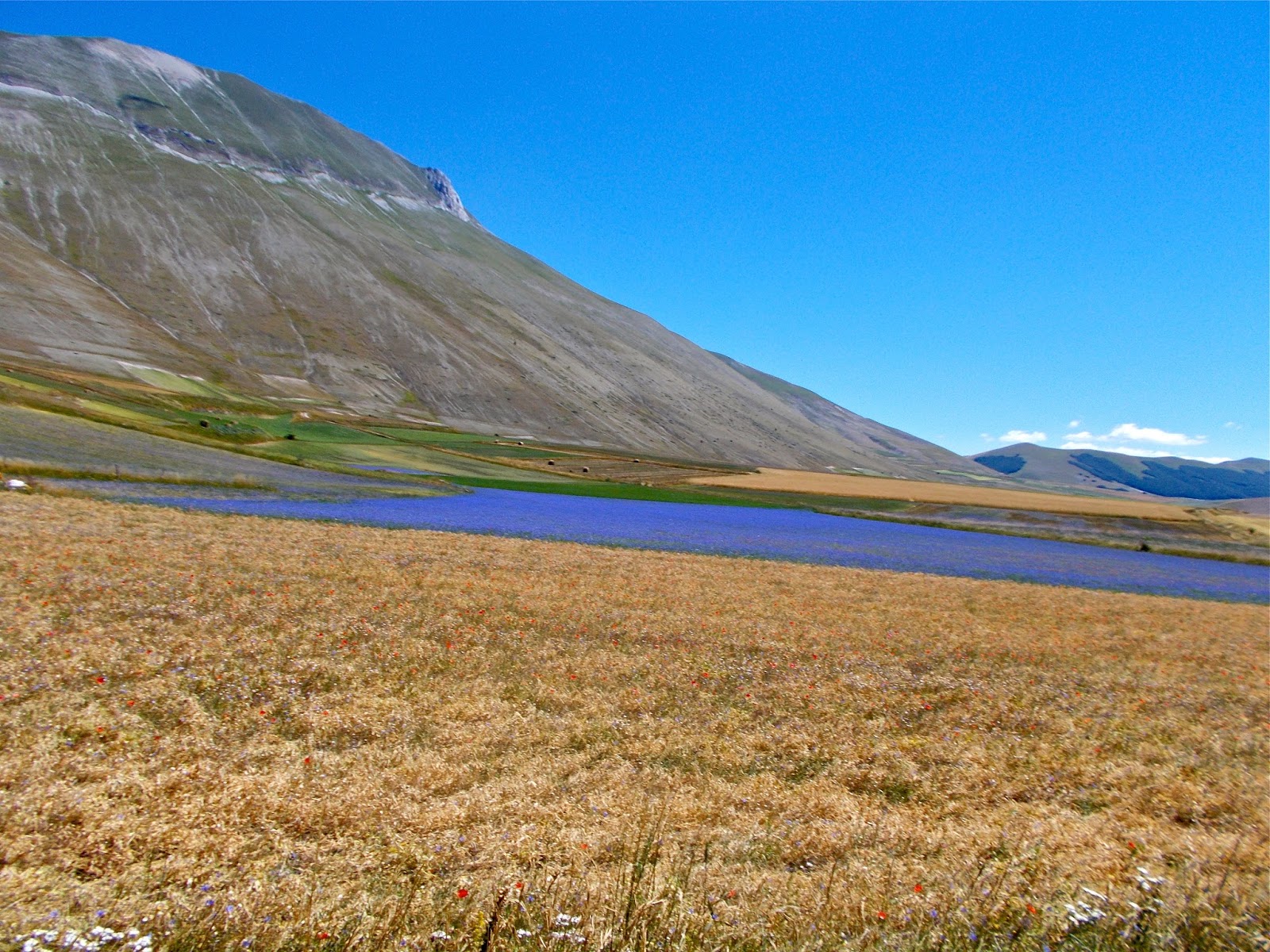
You can still see some blooming in the valley even on 2 agosto.
The total hike with Pizzo thrown in took 5 hours and 5 minutes for the 3 of us, who move along pretty steadily (quickly) and it clocks in at probably around 14 km or just about 8.5 miles.  If you have just one car, I would do the hike out to Pizzo and return, it is one of my favorites!
I will leave you with a photo of Castelluccio from our descent, always a very photogenic spot from any angle.  


Tuesday, July 30, 2013

Mt. Pizzo, Vettore and Torrone hike from Colle, Montegallo, AP, Le Marche

30 Luglio, 2013
It has been a long time since I posted something for you few who have yet to enter the world of facebook, where all my latest is made available daily.
This is an exceptional hike for those who want to climb the tallest mountain in Le Marche without the crowds of the trails from forca di Presta or Castelluccio.  The 1500 meter altitude gain and approximately 15 km distance puts most people off, but if you are up for it, this is a much more interesting way to climb Vettore.  I am on a quest, as is Bacco to climb all the 2,000 meter peaks in Le Marche and after this hike we have 2 to go.  This hike bagged 3 although Mt. Vettore was a 3rd timer.
This picture with our winery in the middle shows all the peaks we climbed on Sunday.
And this view is from a bit closer at the cute little mountain town of Montegallo.  
The hike starts out promisingly enough with a little waterfall and a shaded path which leads to the church below

This is the little church Santa Maria in Pantano built long before Columbus arrived in america

My Belgian guest Sven on the trail up above timber line, with Mt. Torrone behind him. That will be the last of the 3-2,000 meter peaks we will summit on this hike and is on the way down from Vettore.

Bacco is nice enough to rest when I do.
Here is a nice iPhone shot from Sven of Bacco and I atop Mt. Pizzo with Abruzzo in the background

Here I am on the crest from Pizzo to Vettore. We have, at this point, seen only 2 people on the trail and passed them, as I am sure you guessed.

Atop Mt. Vettore where a lightning strike, I imagine, has bent the cross 90 degrees.  The last time Bacco and I were here, the cross was straight.  Note the Tibetan prayer flags tied to the cross. I am wearing my Estes Park, CO shirt and the altitude of this summit, the tallest in the Marche, is the same as that of E.P.  To arrive from trailhead to the top of Vettore with Pizzo thrown in (20 minutes round trip) took 3 hours and 25 minutes.
Mt. Vettore in the background as we walk along the crest you have seen in those pictures from the B&B and Montegallo.  First we head down (and then back up) to Mt. Torrone

Looking west left to right, Cima del Lago, Redentore and Pizzo del Diavolo, all 2,000 meters and above and these make a great hike as well, with wonderful views of Castelluccio and the Piano Grande. Lago di Pilato is below where supposedly Pontius Pilate's body was carried by horses and is home to an endangered crustacean (fresh water shrimp) and above that a nice little heart-shaped snow field.

Heading on down from Vettore on the crest, you see Mt. Sibilla with its awful scar from a giant Zorro.  Behind that is Mt. Priora, another wonderful hike which we started from Rifugio di Fargno last year on another 3 peak day.

Bacco and I atop Mt Torrone

Looking back at Pizzo and Vettore from the pasture below Torrone

A view of Lago di Gerosa and the eastern Marche foothills; it is a bit too hazy to see the Adriatic

Bacco and I had already finished 4 liters of water on this hot Sunday before arriving at a fountain where we found 50 sheep, a lazy shepherd under his umbrella to the left and 3 Abruzzo sheep dogs which tried to menace us a bit, but I played pack leader while Bacco cooled off.
From here it takes another 40 minutes or so to get back to your car for a total of 6 hours and 15 minutes for the 3 of us and just under 15 km or 9 miles.  
It is a big hike, no doubt about it and with almost 5000 feet of altitude gain and loss, not for those who are out of shape.  I liked this approach to Vettore better than the short steep hike from forca di Presta because there were no people, the views are more appealing to me, and you can bag 3 of the tallest Sibillini peaks easily enough in one go.
Enjoy!  


Thursday, May 02, 2013

Where have I been?

2 May, 2013
Hi all, I have been busy posting on our new blog which you can find at our website www.pswinery.it
Check out the newest releases from PS Winery and all the info about the B&B as well.  I will still post here from time to time, but for more frequent updates, you can find me on fb as Dwight Stanford from Offida, Le Marche, italy
this year's irises
Church of St. Francis, Ascoli
Piazza del Popolo, ascoli
My first artichokes of the year!


Tuesday, March 05, 2013

Eremo Colle San Marco, dayhike above Ascoli Piceno

5 Marzo, 2013    Eremo Colle San Marco hike
This is a nice little hike above Ascoli Piceno which one could complete in a couple of hours or spend half a day exploring around the hill and forest where this little hideaway is located.
Here's the explanatory placque at the little church in Piagge where you can start the hike.  Otherwise, drive all the way up to the cemetery and park and walk around said cemetery to the right where you will find the trail leading up to the fork below.

Head left and in just a few minutes you will arrive at the beautiful arched stairway which leads into the little monastery.

This was built 8 hundred years ago, which makes it all the more impressive.  Obviously subsequent works have been done to make the whole thing safer so we can still visit today.

View of the bell tower and the facade which the old Benedictine monks built to close in the grotto.

and another with the imposing cliffs above and below

Alessandra, Bacco and Pippo behind her getting ready to climb the stairway to Eremo Colle San Marco.
The next set of stairs seem to be cut into the rock face as a tunnel of sorts, pictures from below and above.


Maidenhair ferns grow from the grotto and add a bit of hominess to the otherwise spartan hermitage.

Views down to the valley of the Tronto river with Ascoli Piceno, its main city.


An altar

Views of the northern Sibillini mountains.  This is prime real estate!

A nice view of Ascoli Piceno and Mt. Ascensione above


No, the dogs did not desecrate in any way, the grotto.

The final stairway to the grotto where you saw the altar, ferns, etc in the above photos.

One of the few symbols which has not vanished beneath the modern vandals ink.

A view of the calanchi (erosive formations) to the north of Ascoli Piceno.

Some of the monks' works remain on the stone walls, although much faded.

Time to say goodbye to the twin-arched "Tiam" structure.
From Ascoli, head up towards Colle San Marco to the south.  You will pass a nice osteria called C'era una volta and later reach the little town of Piagge.  Just before exiting the town, you will see a little brown sign on your right with a sharp right turn to get up to the little church of San Bartolomeo where you can park and read the sign above in either italian or english before taking the trail to the left of the church up to the cemetery.  You can save a couple of hundred meters climbing if you park instead at the cemetery.  Either way, the trail starts to the right of the enclosed cemetery and not to the left which also has a well marked road but is posted as private property.  The climb is easy and takes 15 minutes or a bit more and is well marked.